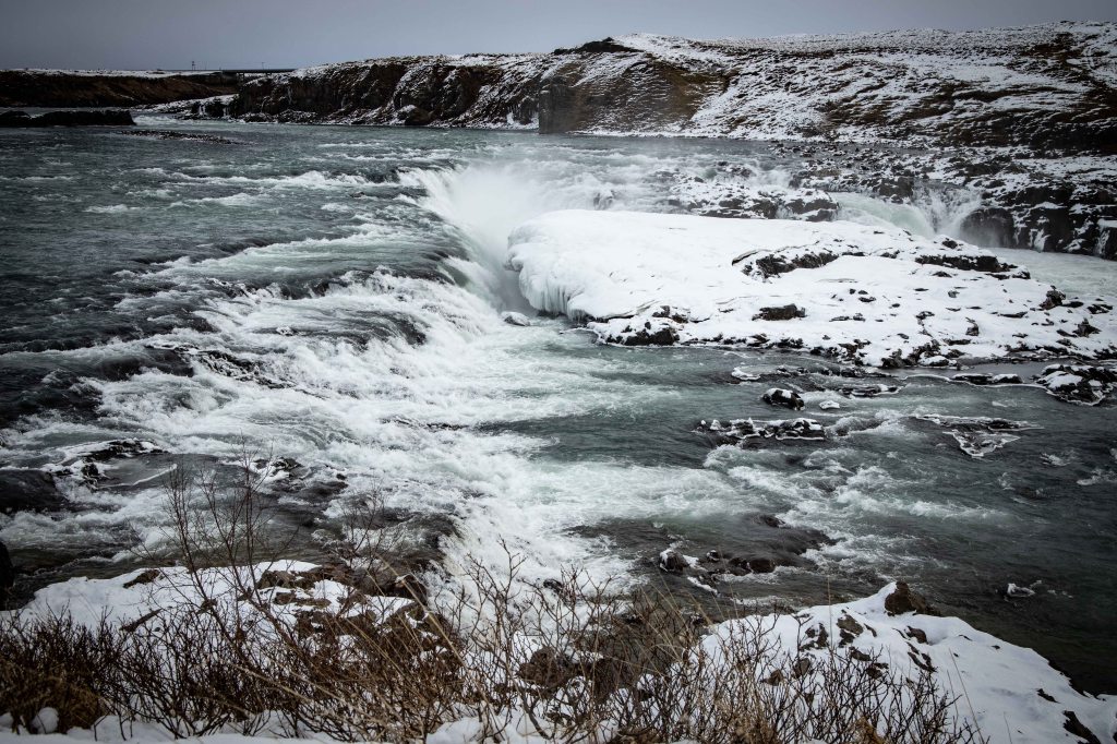
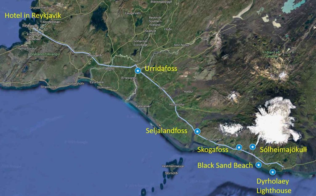
It was bitterly cold when we arrived at Urriðafoss (ur-rid-a-foss) and the icy wind gnawed at our exposed faces. This lesser-known waterfall is Iceland’s largest by water volume and situated towards the mouth of Iceland’s longest river – the Þjórsá (thor-sa). There are potential plans to build a hydro-plant just upstream which would result in this dramatic scene disappearing and there is a debate going on about whether or not this should proceed.
For now, we followed the short snow covered path from the car to the edge of the river, the hidden ice underfoot resulting in the occasional slide towards the rocky shore. This was the coldest we’d felt in Iceland but I loved the awesome scale of this waterfall and stayed as long as I could before retreating to the warmth of the car.
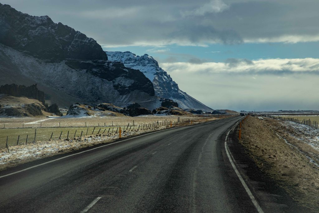
It had been raining and snowing since we left the hotel for the ~1hr journey to Urriðafoss. However, as we journeyed on, the weather cleared as if to highlight the dramatic beauty of the rugged landscape of Iceland’s south coast. The massive Eyjafjallajökull volcano loomed large to the north and I pondered its last eruption in 2010 which causing disruption to flights all over Europe. From under its snow covered peaks, the black rock of the volcano sides tumbled out towards the road before ending in a high escarpment and then dropped down to the the flat coastal plains on which we drove.
In places, the melt-water flowed over the edge of the black escarpment forming many different waterfalls. Our next stop was a particularly beautiful waterfall known as Seljalandsfoss where the waters of the Seljalands river fall 60 meters into an pool and onward river below. The slow erosion of the falls against the bottom of the cliff has created a shallow cave into which an icy path provides a way to walk all the way behind the waterfall.
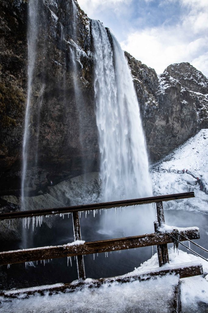
The spray from the falls ensured everything had a covering layer of ice and getting anywhere proved tricky. I climbed the nearby wooden stairs but without crampons – it took a while to negotiate my way to the top of a frosty viewing platform. Here the icy spray quickly covered me, but getting so close to the powerful cascade made it worthwhile. The downward retreat was made easier by using a frozen rope as a guide to abseil down the side of the stairs which had proved so tricky on the way up.
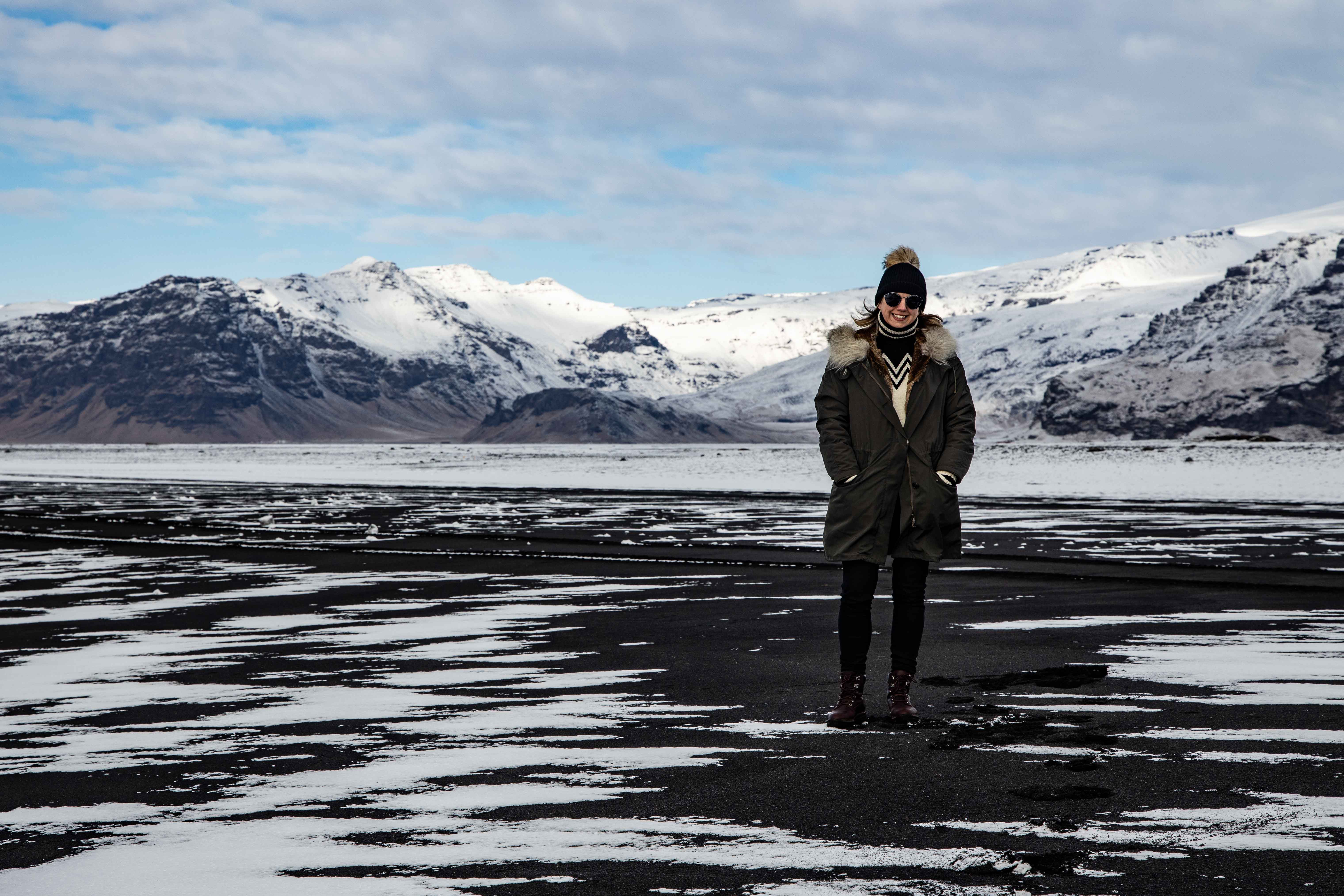
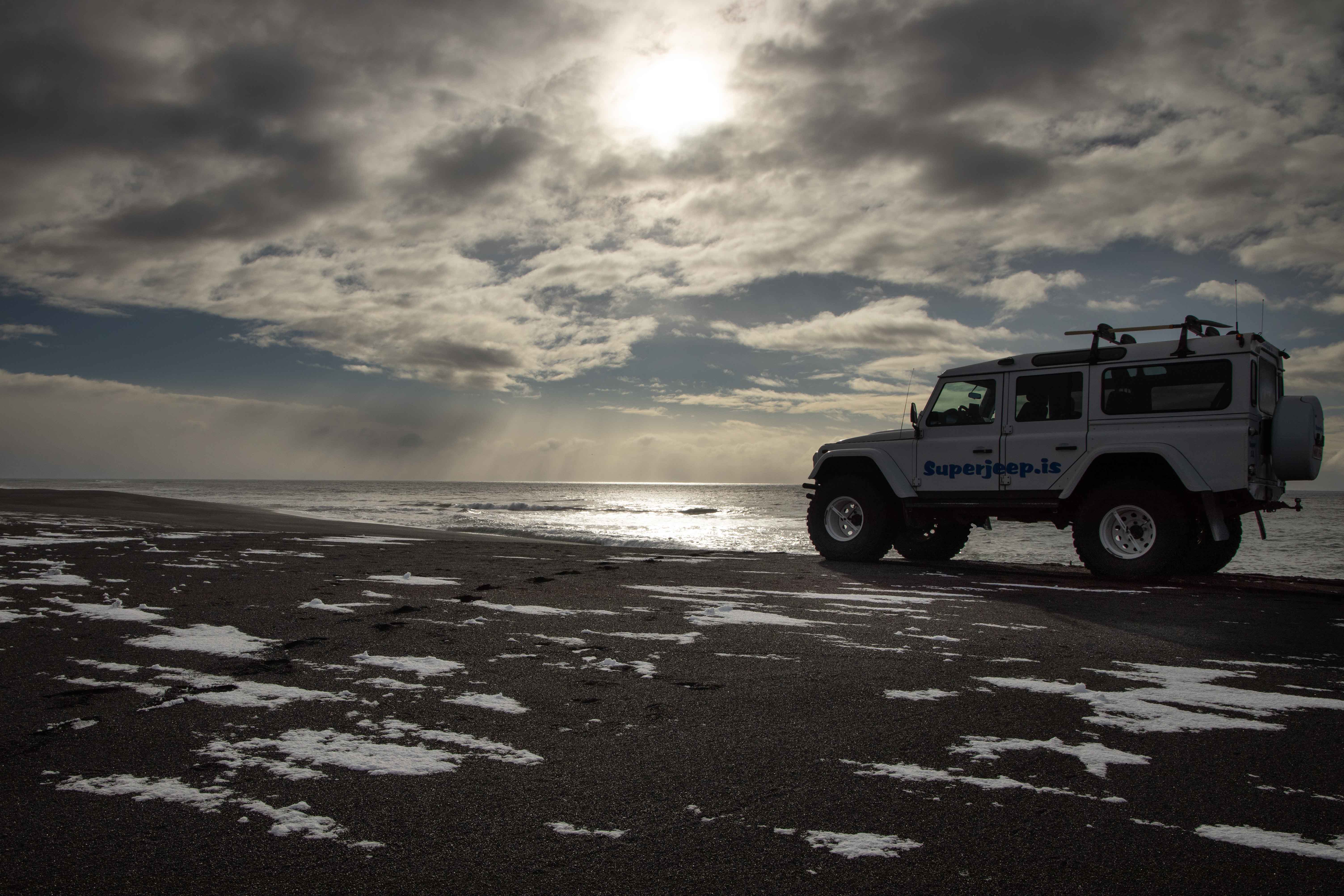
Continuing our coastal journey, it was another 30 minutes before it was time to go off road. We turned south towards the sea and found ourselves driving along the sands of a long, wide black beach. The pummeling from the sea of the black lava rock had resulted in miles of black beaches all along this coast. The views were incredible. The dramatic coastline with crashing waves of the north Atlantic ocean, and behind us we could see the full range of volcanoes all along the south of Iceland.
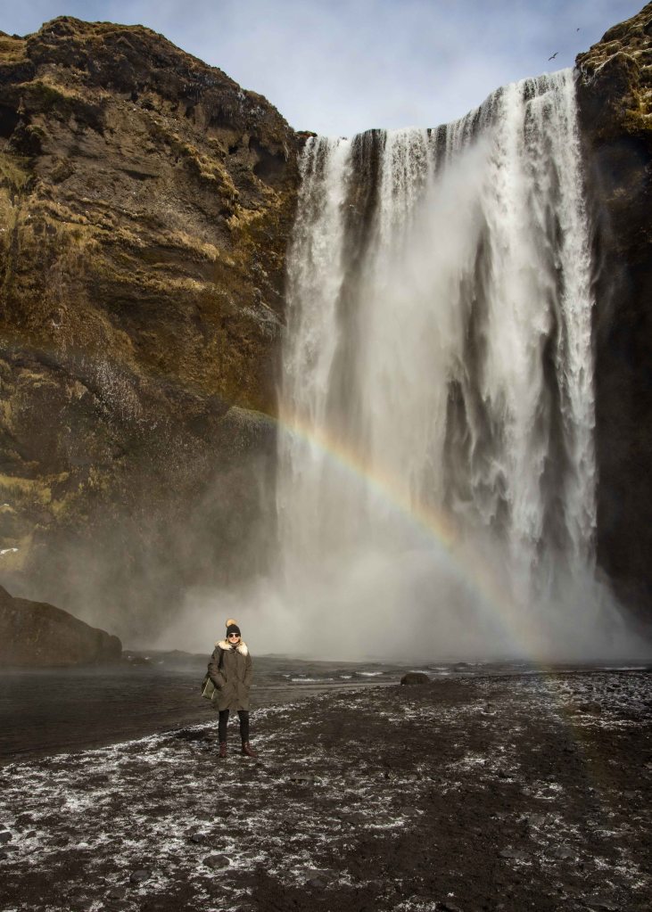
Not from from where we rejoined the main road was another waterfall known as Skogafoss. It had a completely different character to Seljalandfoss – shorter and wider but nestled in a beautiful gorge. Rachael climbed the path to come out on top of the waterfall whilst I explored the river below and then we rejoined to head further into the gorge towards the base of the falls. We got as close as we could before the cold spray became too much but the crashing water and the surrounding rocky cauldron made this an awesome sight.
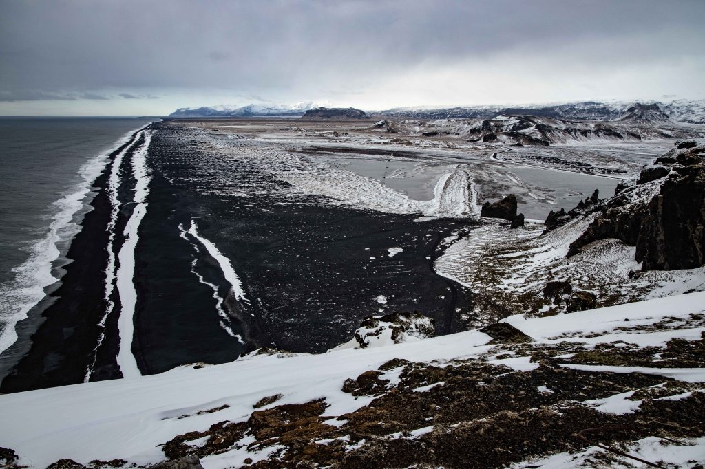
There was a cafe restaurant here but it was busy with tourists so we drove onto towards Vik, eventually finding a local place which served us two very tasty burgers. Vik was as far as we would be going and it is a shame as there is so much to see that a day is not enough time. We would have to save many things for another trip but there was still things to do on our return journey. Our next stop was a rocky outcrop, quite isolated from the main volcano range and right on the edge of the shore. Perched on top was the Dyrholaey Lighthouse and we drove up the steep gravel road before getting out to take around the top taking in the views on all sides. Down below, the waves crashed at the rocky cliffs on which all sorts of sea-birds had made their nests. There were great views along the coast and back towards the volcanoes but the weather was closing in again and the temperature was dropping.
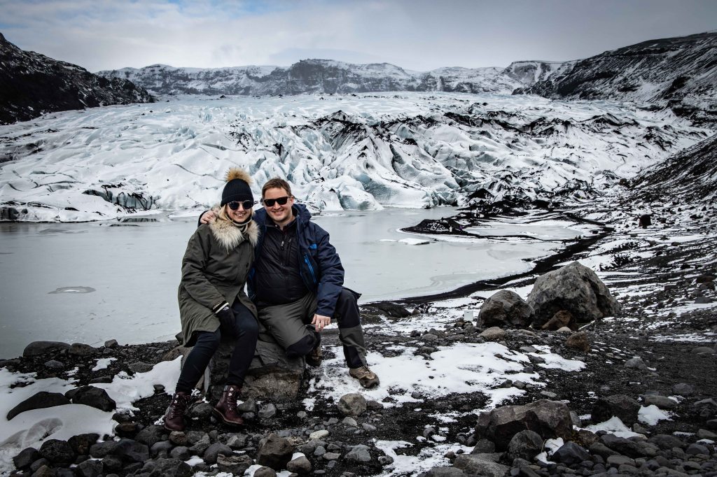
There was one final stop before our final leg back to Reykjavik and that was to visit the Sólheimajökull glacier. It was about a 20 minute walk from the car-park, along the carved valley left behind by the retreating glacier until we reached its head. We weren’t kitted out and didn’t have the time to do a proper walk on the ice but the views of the glacier from here were beautiful. The valley and previous photos showed how far the glacier had retreated in recent years (several hundred meters) and it is a sad to think that future generations may not be able to see this incredible landscape as it is today.
Sadly this last visit was we would have time for on this one day journey along the south coast – but it had been an amazing day and we were already planning to explore further east the next time we come to Iceland.

This looks and sounds like an incredible adventure! Thanks for sharing it with us and keep up the great content.
LikeLike